Archive

November 2015

Browsing

With up to 10,000 visitors in a single day, is Maya Bay worth going to? Maya Bay sits along Phi Phi Islands and has gained most of it’s popularity from the movie, “The Beach”, starring Leonardio DiCaprio. Me along with thousands of others wanted to see this piece of paradise and so I did what everyone else did and signed up for a day tour. I have to say I was happy about the way our guide was able to manage our timing throughout the day. We arrived about 20 minutes before we started seeing a school of water vessels coming in from every direction and letting off dozens of people at a time. It’s hard to take notice of this tropical paradise when it’s ruined by hundreds of people interrupting your beautiful view with their selfie sticks and fancy DSLRs. While I’m appreciative I got to knock this one off my “Thailand Bucket List” I can honestly say that I wouldn’t return again. The bay is simply too small for the amount of visitors it attracts.


Discovering Bangkok’s food scene can be overwhelming. Here I’ve created a half-day foodie itinerary where you’ll be able to find some of the oldest recipes in Phra Nakorn, one of fifty Bangkok districts. 

SAM PRANG, PHRA NAKORN DISTRICT

FLOW: Begin with breakfast having an original and traditional crispy pancake for breakfast and then a 70-year-old ice cream recipe for lunch snack at Tha Chang Pier. If that doesn’t already curb your appetite, you can take a bus or tuk-tuk to another area of Phra Nokorn District for a traditional Thai lunch and dessert.

1. Khanom Bueang: Crispy Pancakes
Address: 91 Prang Nara Road, Choa Por Sua Shrine Sub-district
Opening Hours: 11:00 am – 05:00 pm (every day except Sundays)
Bus Lines: 2 or 60

Crispy pancakes aren’t commonly found on the streets of Bangkok due to the amount of labor involved it take to prepare it. This original and traditional 100-year old recipe still exists from the King Rama V reign. It was once presented to the royal family and has been in the royal family ever since. You can order it sweet or savory and buy one pancake for about 30 baht (approximately $1 USD). Some find this expensive for Thai local standards, but you get what you pay for and here that means deliciousness and arguably the best you’ll find. The business is now being run by Mrs. Somsri Hirunwatit, the granddaughter-in-law of the royal family.

There’s no wrong time ever to have ice cream so make your way over to Natthaporn at your leisure. It’s in the same sub-district.

2. Natthaporn: Coconut Milk Ice Cream
Address: 94 Building next to the Ministry of Interior, Prang Prootorn Rd.
Opening Hours: 09:00 am – 05:00 pm (every day except Sundays)
Bus Lines: 2 or 60

This Thai homemade ice cream recipe is more than 70 years old. They strive for only the best ingredients, and there are no preservatives. We love that! Some of their toppings include red bean, peanut, lotus seeds, crispy roasted mung bean, sticky rice, corn, taro, and toddy palm.

Now that you’ve had your appetizer move into a late lunch over to Sao Chingcha sub-district.

3. Pochsapakarn Restaurant: Thai Food
Address: 443 Buildings opposite to the Chao Por Sua Shrine, Tanow Rd.
Opening Hours: 10:30 am – 2:30 pm (M-F) / 11:00 am – 9:30 pm (S, S)
Bus Lines: 33, 64, 508

One of Bangkok’s oldest restaurants having been opened for more than 90 years! Here you’ll find distinguished Thai spicy style. This is the same style used to serve the Royal family and passed through generations.

I hope you saved just a little more room for dessert! You might be thinking, wasn’t that the ice cream? But, no, you can’t leave Thailand without having some of their mango sticky rice!

4. Khao Nio Kor Panit: Sticky Rice with Fruit
Address: 431-433 Buildings behind the Ministry of Interior, Tanow Rd.
Bus Lines: 33, 64, 508

Now that you’ve made it this far, you’ll want to head over to Khao Nio Kor Panit for some sticky rice mixed with coconut cream. This establishment has been recognized by TV programs, magazines, and different forms of media. While I did mention to try the mango with sticky rice, this is a place you can actually explore other fruit when mangos aren’t in season; something not found at a lot of other places.

I hope you enjoyed my one-day traditional Thai foodie tour. Please let me know what you think in the comments below.

You’ve heard the story a million times about the idiot hikers who go against the grain and abandon all reason. This is my story about two Americans and a Canadian, who got lost in the middle of a jungle. Yes, this already sounds like a punch line to a horrible joke but this was my recent reality two days ago.

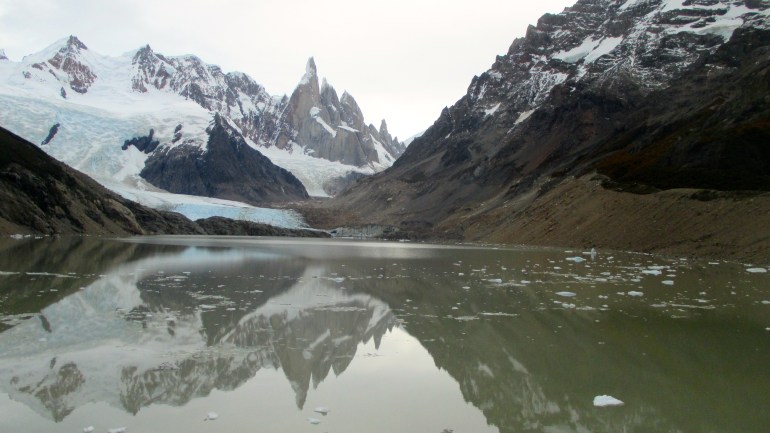
It all starts with a brilliant idea to go for a sunset jungle hike in Doi Suthep National Park in Chiang Mai, Thailand. My two friends only arrived a couple of day’s prior, and we wanted to explore all of the great nature that this outdoorsy town has to offer.

I just rented a 2015 fire engine red Fira motorbike that morning and, having never actually driven one myself, I asked my experienced travel blogger friend (www.skyetravels.com), Skye, to take charge. The three of us piggyback onto my scooter holding on for our dear life as we drove up the canyon to a little village, the farthest point we could go before we had to get taken to the next highest point by a songthaew that can be best described as a hybrid tuk-tuk truck.

Our first sign of warning should have been one of the songthaew drivers who, in his very animated attempt to speak Thai-English, tried to tell us it was a bad idea. He waved both of his hands simultaneously from side to side saying “No, no, no!” Then followed up with him running in place wiping the sweat from his forehead. It pretty much looked like he said we were about to walk ourselves into death.

We convinced him anyway to drive us about 6 km up the road for 50 baht (approximately $1.50 USD) per person. We even recruited a solo Malaysian traveler to help reduce our cost.

Our driver kept insisting on giving us a ride to the very last point, but we needed to burn off some late night calories from the night before that we asked him to drop us off at one point of the trail where we found a small temple ruin just beyond the Doi Pui View Point.

It was nearly 3:00 pm at this point and I still never really understood how many kilometers the entire hike was. I just figured we’d see signs along the way and figure it out from there.

About 30-45 minutes into the hike we pass a campground where we saw a sign saying it was 4 km before the next village. I facetiously say, “At least we have a place to sleep if we don’t make it back out in time!” This is our last point for restrooms before be begin our 15 km hike.

Campground

Our Malaysian friend had to turn around at this point because he had been bitten by a dog the day prior and needed to get his second rabies shot. Either that or he had a feeling we were headed into a path of doom.

As we’re leaving the campground, I keep doing the math in my head. It’s nearly 3:30 pm and we still have a lot of terrains to cover. I ignore all reason, stay quiet, and convince myself it’ll be an adventure either way. We can always turn back around at the village if it didn’t work out. Ironically, later, I found out that I wasn’t the only one who had that same thought.

We continue onto our trail and pass a few local hikers who looked like they were on their way back. When we asked how far the trek was ahead and they said we likely wouldn’t make it in time and wouldn’t recommend it.

There goes another sign. Again, all of the signs were leading up to our idiocy.

Not long after we pass them a family in a white pickup truck pull over and offer us a ride. We gladly accepted a ride hopping in the back of their trunk bed with their son (who looked maybe under ten years old) into the nearest village shaving about another 4 km of time to our sunset hike.

Once we get into the village, also known for their coffee, we are the only foreigners around. We see little shops of handmade goodies by the local tribe women. You could hear a medium sized group of children on the opposite side of the road laughing and playing. We see them chasing each other in the distance back and forth on their bikes in tandem with roosters trying to steer clear of their direction. Some of the boys used sticks for toys when they were on foot and their life seemed simply joyful by my standards. It was pretty refreshing to see a culture not self reliant by their iPads, iPhones, or iWants.

Kids in the Village

We spend another 40 minutes in the local village and come to a group decision that we’re not going to turn around and instead continue with our hike.

A woman dressed up in local tribe attire offered to give us directions to the trail that led to Doi Suthep temple. She points at an unidentifiable dirt trail behind a shack, and we decided to head on our way at about 5 pm.

The path before doom

The hike led us by orange markers tied to trees, but after about an hour and a half, we lost our trail. We still had faith we’d find another marker and decided to keep going until a few meters were now coming to a close kilometer.

The delicately rosy sky began to set ardently over the jungle, and we’re reminded why we decided to keep moving past the last village. There hasn’t been a person in sight for miles except for the few rice farmers we passed along the way.

It’s only minutes before dusk and the trail came to a complete halt. There was no longer a pathway and we’re at least an hour away from the village at this point. We decide to walk off-trail up the mountain seeing if we’d find something that connected back to the trail but as it got darker we began to feel a sense of frustration. It essentially led to another dead end.

The adventure now begins.

We decide the only thing we could do is backtrack, but it was very difficult to do so when you don’t know your way around the jungle and the orange markers are almost impossible to find. The now cauldron-black sky led us with no choice but to use our iPhone flashlights and questionably reliable Google Maps.

Nearly 4 hours without a person in sight as we trailed through dead ends, different paths that led to even more dead ends, and all while Google Maps kept pin balling us through the center of this National Park.

We talked about anything to distract us from any weird crackles we heard in the distance and the buzzing insects flying around at night. We even began a game of dare to keep our minds from feeling like we were lost, but that quickly ended when I dared Skye to do a 3-time cartwheel and he almost ate it. At this point we all wanted our limbs to be working together so we didn’t have to haul around any extra weight.

My Canadian friend’s legs were getting desperately tired taking many breaks along the way. We did everything to remain as a team in a moment of high stress and had a discussion about at what point we think she should call for a search and rescue team.

Finally just after 9 pm, and literally on the very last trail we had faith in, we see a light up in the distance. I’m not optimistic at this point because we saw many lights in the distance that led us back into the black night. It wasn’t until we began seeing more signs of civilization like a motorbike followed by (insert celebratory music here) an orange marker!

I’m running as fast as I can to the top of the mountain (in my mind) while my legs moved as slow as molasses. It’s true! We see a light to a home! Skye runs with speedy conviction to let them know we’re here.

At this point, I have a mixed range of emotions. In the back of my mind I’m hoping this isn’t the home of some serial killer because the profile would fit perfect all alone in the middle of the woods. While the other part of me was hoping I’d have this inspiring story to share about how some local villagers generously welcomed us with open arms into their homes with a hot meal and a night exchanging knowledge about our culture.

Instead, we were greeted by a farmer and his albino wife who offered us a place to sit and a ride back 8 kilometers to the village for 800 baht (about $25 USD). We gladly accept and see this as our contribution to feeding them for a month. They warm up the truck and take us to where my 2015 fire engine red Fira parked all lonesome in the desolate parking lot. We gave the couple American and Canadian hugs for not chopping us up and taking us back to our vehicle. What a relief!

Yes, we can now say escaped the idiot hiker story not having any newspaper coverage about us the following morning, but don’t do what we did. Know your trails, go with your instincts, let people know where you’re headed, and don’t hike on trails in third-world countries you’ve never been in without a supervised guide. Then again, where’s the adventure in that?


This is among one of the most sensitive subjects among travelers you can talk about when it comes to Thailand tourism. Is riding an elephant morally wrong and unethical?

I only know what I’ve researched. I can’t say I have any “evidence” supporting the facts, but I’ll tell you my story. If after doing your own research you think it’s still okay to ride an elephant, who am I to tell you judge and tell you that you can’t? We all doing things that are considered unethical at one point or another and each person is unique to his/her own values – whether it’s not supporting animal bi-products to not supporting what some perceive as abuse.

It was the first week into Thailand and I knew I wanted to see elephants. I mean…it’s the thing to do when you’re out here. To personally engage with them seems like such an enriching experience, doesn’t it?

After doing a little research, I found dozens of articles about how elephants that are chained are being abused to support tourism. The elephants are working long hours and that their backs aren’t meant to carry all the weight. You will even find stories about elephants killing their owner out of rage.

I was in Krabi, a cute little beach town in South Thailand. I had a week long visit and wanted to book a tour to get away from the hotel. I find a little kiosk where a lady had a list of tour packages available and she was prepared to give me a good deal. There was one, particularly, that stood out. It was a three-part tour visiting a local hot spring, a Tiger Temple, and then ending with a short 10-minute elephant ride. In as many ways as I could ask if the elephant riding was done in a humane way, it was impossible to get her to understand me. I went against my gut and figured if I didn’t feel right about it, I wouldn’t do it.

We go to the other stops and then finally get to the elephant camp. Everything happened so quickly that before I even had time to think I found myself stepping on one of their backs so that I could enjoy a “bucket list” item of mine at the expense of the animal. Truthfully, I felt like a horrible person the entire time and I couldn’t wait to get off. Here two people are sitting on their backs while a third (mahout) sat on its neck guiding the elephant with a bullhook. I literally felt like I was supporting animal cruelty and this made me a bad person.

I guess the only way I can justify my experience to make me feel less awful about it was that it was a very short ride of about 10 minutes.

I feel morally wrong about. My intuition told me it wasn’t right and I ultimately did something I didn’t feel morally right about. The mahout kept jumping off to get photos, but I kept declining because I didn’t want any photos showing I actually supported this.

My elephant ride eventually ended and there was a little stand nearby that sold bananas for us to feed them with. I bought some feeling it was the only way I could tell them I was sorry.

Is riding an elephant wrong? I’ll leave that up to you to decide, but all I have to say is do your research. There are so many other enriching ways to spend with them which I eventually did further into my trip by volunteering at an elephant sanctuary.

It was a day of gale force winds. This blustery morning could pull the horns off an ox. I lay on the bottom bunk in my bed of a six-bed dorm room feeling paralyzed by the howling gusts over the last several hours. Am I going to make this 10-hour roundtrip Fitz Roy hike today?

It’s nearly 7 am and we have to make it back in time for our 6 pm bus ride back into El Calafaté. The clanking of debris against the two-story hostel continues, and I’m convincing myself that it’s a bad idea to go on this hike as the muscle fatigue reminds me.

My alarm begins buzzing. Screw it. I already climbed three mountains in four days. I can let this one slide. The alarm buzzes again. Ugh, I don’t want to go. It sounds violent out there!

I hear my brother from above calling my name asking if we’re still going to go on this hike. We see a couple of other backpackers silently making their way out, so I tell my brother it’s his call.

He responds, “We should go.”

Argh! It’s not the answer I wanted to hear, but it’s our last hike in Argentina. I put emotions aside in the “whining” reserve box and get dressed. We briefly stop at a little market to pick up some food for our trip, and I scarf down a salami sandwich with a coffee before we begin our journey. It’s not necessarily the greatest food pairing, but neither was the temperamental weather to my hike.

I’m feeling a little cranky as we make our way to the head trail that begins at Avenida San Martin. We have about an hour of steep slope until we reach the Del Salto stream valley.

Fitz Roy Entrance

We’re walking along the outer edge of a mountain trail staring into the open valley. I’m often wondering if I’m going to get blown over or lose my balance during moments pushed by the frequent and yet fickle wind.

Fitz Roy: Del Salto Valley

The trail eventually takes us deeper into the woods through Antartic beech and eventually to a well-marked viewpoint after about another hour into our hike. Okay, okay. I now get what all the fuss is. It’s surreal in every way!

Fitz Roy

We find ourselves passing a small stream from Del Salta where we refill our water bottles from the river. It’s one of the few places in the world we could still safely do this.

We’re making excellent time seeing the great landscapes of Lagunas Madre e Hija, passing other hikers often, and are now at Poincenot campground and about 45 minutes ahead of schedule. There weren’t too many campers around. I think they probably camped overnight making this trek a two-part journey and finishing the rest of the hike today.

marshy lagoon

We’re getting closer, and I’m surprisingly feeling energized giving partial credit to my “Wanderlust” playlist with artist selections like Odezsa, Flume, and Rudimental to get me through this.

20150327_142747

The last 400 meters has warning signs letting hikers know how difficult and steep the last ascent was to get to Laguna de Los Tres Glacier. Blue Sky Black Death! We just hiked nearly 3 1/2 hours to get here, so this a point of no return as far as I’m concerned.

I confidently have my “Do or Die!” enthusiasm before the incline starts to seep deep into my muscles. Mother-effer this is tough. I’m preserving my oxygen controlling my breathing patterns to keep me going at a slow pace. My heart is in overdrive beating hard against my chest, and I’m perspiring more than ever. I’m using what support I can hold onto using the sporadically placed ropes or gripping rocks to pull my body weight through each climbing step.

I see others who couldn’t make it and taking short breaks along the way and finally decide to join some. I tell my brother to keep going without me, and I’ll catch up. He can tolerate the burns a bit more than I can.

I continue with the last part of my journey receiving encouragement from other hikers on their way down telling me I’m almost there.

I finally make it to the bottom of a loose granite hill. I can see people lined at the top, so I know I’m almost there. With each step, it’s like stepping into quicksand. You take one step up, and it slides you back down a bit. In other words, this hill is a b*tch! I see others passing me and fancying their walking sticks. Damn it! I want to fancy a pair of those.

Alas! After over 3,300 meters total, I am greeted by the luminous presence of an emerald lake against the granite peaks of Mount Fitz Roy. I’m mentally adding this to my top ten of most spectacular displays of nature I’ve witnessed thus far.

Emerald Lagoon at Fitz Roy

I find my brother (having trailed 30 minutes behind him), and we find a flat boulder to eat our sandwich that we picked up from the local market earlier that morning. There were maybe 20-30 others at the lagoon, but compared to how open it felt, it didn’t feel crowded. From the distance above, we see a crazy Australian (whom we later met) who took his clothes off and jumped into the lagoon. Crazy Aussies!

I didn’t realize how sore my muscles were until I tried to get up from the boulder at lunch, but we had another 4-hour descent to catch our 6 pm bus. We trace back through trails we saw earlier that day and on my last several hundred meters my feet were dragging, but when I put my “Wanderlust” playlist back on it gave me that extra boost of mental Red Bull. My brother waits for me at the bottom and I run toward him in slow motion listening to “Chariots of Fire” in my head as I ran through a makeshift version of a finish line. I victoriously hiked four mountains in five days, one of the most strenuous series of activities I’ve ever done and that in itself feels like a huge accomplishment.

And, while I bitched and moaned about the wind… if it weren’t for the strong winds, we would have never seen such great portraits of the Patagonian mountains. If it weren’t for second and third and fourth winds, I would never have made to the emerald lagoon shared by the otherworldly shaped, Mount Fitz Roy.


Here I am in El Chaltén, Argentina’s trekking capital of the world. It’s late morning, and I’m just getting off my bus stop to walk to a hostel where I’ll be spending a small amount of time over the next two days with my little brother.

El Chalten Bienvenidos

El Chaltén is a small village nestled a few hours away from popular travel destination, El Calafaté. It’s infamous for its tempestuous weather but the home to a four-mountain chain; Cerro Torre, Torre Egger, Punta Herron, and Cerro Standhart. It’s also a vestibule for adventure warriors and climbers.

4 Glacier Mountains

My brother and I check into our six bedroom dorm, drop our things off, and then hustle our way onto a 7.3 km trail to Laguna Torre, a focal point of Cerro Torre where you can view a glacier lake and rime ice. At this point, it’s already early afternoon, and we’re going to have to race the sunset with a six-hour round trip journey. Luckily, we just missed a storm leaving us optimistically with 68-degree highs, white blanket skies and easy-going weather conditions.

We make our way through town in a matter of minutes climbing a steep hill to the base of the trail where we find signs pointing us in the right direction.

Laguna Torre Sign

The hike itself is of moderate difficulty, but you quickly forget when you pass a river and a waterfall followed by a mystically intriguing open valley of decapitated trees with Cerro Torre in the distance.

IMG_3222 (1)

Even though this is a popular trail for trekkers, I didn’t feel as though our experience was compromised in any way. There were very few hikers along the path, and we only ran into one small group of young backpackers who were daring enough to unpack their tents for an overnight stay.

We finally make it to Laguna Torre and were welcomed with a hidden slate-colored lagoon.

IMG_3229

Up close, Cerro Torre looked like a backdrop of an Ansel Adams photo. The atmosphere changed a bit bringing in cooler temperatures than I anticipated. The blanketed skies opened up, and the wind was picking up lightly. Everything began to feel more solitaire.

IMG_3218

It’s nearly 6 pm at this point, and we want to hustle our way back into town before it gets too dark. We’re racing against the sunset with dense clouds fleeting. The 50 shades of gray transformed into one of the most powerful and beautiful Cerro Torre sunsets Patagonia had to offer us.

Cerro Torre Sunset
The beautiful Cerro Torre Sunset

Do you think this was worth the three bus rides and 19 hours of travel to get here? Tell me what you think in the comment section below.

The halcyon sunrise begins to peak as eight trekkers share their first steps into the brisk morning of Terra Mayor Valley.

Stop to Tierra Mayor Valley
Drop-off point in Tierra Mayor Valley

I felt something unique with this group. On this day, we were going to be the only ones in the world to be at the summit of Glaciar Ojo del Albino (The Eye of the Albino Glacier). Nobody could replace this one-of-a-kind experience unless they were there with us on that given day. The next twelve hours were about to be challenged with heaps of mud, steep inclines through crumbling rocks, hiking alongside rivers, and massive amounts of ice. I am thrilled.

Peatlands
Beginning of our trek through the peatlands.

After a brief orientation at a private lodge between Sorondo’s Mountain and Alvear Mountain, in the middle of The Andes, we traverse through the Autumn-colored peatlands in our 12″ high rainboots beginning at 250 meters above sea level. Each of us is carefully watching our step learning by the mistakes of others who misstep into a sloping mudhole. There were a couple of lost boots along the way but nothing that couldn’t be fished out after a good laugh.

My rain boots were the cutest!

After about one kilometer, we finally reach a more stable ground and change into our hiking shoes leaving our rain boots behind. There’s no stopping us now as we move into a new terrain filled with dirt trails and a pearly-blue beaver dam. Now I understood why I saw so many fallen trees. I initially just assumed they were rotted or struck by lightening, but, no, they gnawed to an apple core by the beavers. Resourceful little fuckers.

Scenic view to Laguna Esmeralda

As we go deeper into the enchanted forest (and all while secretly hoping I’d fulfill some whimsical fantasy by discovering a little gnome), we begin trailing along Esmeralda River and muddier paths. I strategically hopscotch around the mud holes and successfully avoid falling flat on my ass.

A moment of no mud as we approach Laguna Esmeralda.

After about two hours into the hike, we finally make our first stop to Laguna Esmeralda, a homonymous blue-green lagoon coupled the glassy translucent mountains that reflected from it. That moment was nothing less than a cynosure elixir. I take a deep breath, sigh, and become intoxicated by the beauty. How could I be so lucky? This lagoon was mine and only shared with twelve others. Nature’s magic trick.

IMG_3124

I wanted to stay longer, but we still had a very long trek ahead of us. As we gain elevation, the environment changes around us. It’s getting cooler, and the Coppertone boulders, mineral gravel, and pockets of snow replace the mushy alpine trails.

20150324_143439

We get one last glimpse of Laguna Esmeralda, and then it disappears.

Jumping for one last look of the lagoon.

The trail ahead continues up to a 30-45 degree incline. I’m feeling the burn in my thighs and focusing on my breathing exercise. In through my nose, out through my mouth. Again, I repeat the words in my head and continue to preserve my oxygen until we get passed this stretch.

Putting on gear for our rock climb.

We take a break by a small stream of water caused by a melting glacier and snow and notice a little hole near a rock. My brother goes to check it out, and we discover a cave hidden underneath the snow. We grab our flashlights and take a peak. I’m a little nervous hoping there aren’t any weird creatures like I saw in the movie, The Descent, but quickly let the nervousness settle. I even make peace with this cool discovery and fill up my water bottle with the glacier water.

20' rock that we need to climb.
20′ cliff that we need to rock climb.

We’re finally at the last stretch. All we need to do is climb this twenty-foot cliff, use whatever energy we have on reserve to get over the last 1/4 mile 60-degree incline, and we’re there.

IMG_3148

We are greeted by the Albino’s Eye; a milky virgin body of water with continental icebergs. The glacier is flat with many dark indigo caverns.

IMG_3160

Ice Clamps
Clamp-ons will save your life in these conditions.

The glacier can be extremely slick to walk on with our shoes, so we quickly put on our ice clamps exploring sharp peaks of the subterranean caverns that seemed so small in the distance but so wide where you’re paired next to them.

Deep and wide caverns.
Deep and wide cavern.

My ebullience compares to a child’s first time riding a bike; fearless, victorious, and I’m elated.

20150324_142108_002

Ladies and gentlemen, I’ve reached my very first summit.

Heart-shaped glacier pocket.


After a 31-hour bus ride, a ferry, and a passport stamp from Chile, my brother and I finally arrive at Ushuaia, the southernmost city in the world.

Me taking a selfie on the bus as it just drove us debatingly safe onto a large ferry transport.

We finally get a cab to take us to Cruz del Sur Hostel just after 8 pm. At the door entrance, we see a long roster of guests who obeyed the “no shoes allowed policy” with a bookshelf of boots all lined up in military style. We’re immediately asked by the receptionist to take off our shoes as well, which I didn’t mind because it kept the hostel clean from dirty mountain trekkers like me.

As we’re waiting in line for a few other backpackers to be checked in, I hear the chatter a few meters ahead where we see a small group of travelers drinking beer and socializing, all representing their country as if it were the Model U.N. It wasn’t long before we checked in and paid our $210 ARS ($21) each per night, we hear list of more rules before getting situated in our 6 room dorm and falling asleep so that we could prepare for a light warm up hike in the morning.

We did a little research about outdoor activities in the area and read about Glaciar Martial (Martial Glacier). It didn’t cost any money to hike the mountain and it was only a 2-3 hour hike to get to the glacier. We used the opportunity to sleep in a little, find the visitor center to get our passport stamped with the Ushuaia logo (in hindsight, I probably shouldn’t have wasted a portion of my passport but it seemed novelty at the time). We make one final stop at a tour company’s office to book a full-day excursion the following day to Glaciar del Albino (Albino Glacier) before they helped us get a taxi cab to the base of the mountain.

The drive from Ushuaia city to town is only a few kilometers, but I’d recommend taking a cab instead walking it – unless you’re on a super budget – which I did see a solo female backpacker doing. It’s a paved and windy road so the walk is doable if the weather is nice.

Once you reach the base of the mountain and where the trail begins, there’s a cute little ski lodge, Refugio de Montana, where you can either dine or take away. We hadn’t eaten any food all morning and ended up doing both having a light breakfast and then a sandwich for the hike.

The base of Martial Glacier trail.

The trail itself has a fairly easy ascent, but there were parts of the trail where you found yourself hiking on spongy-like and sometimes muddy terrains.

Spongy Trail Glacier Martial

There are several great viewpoints where you can see a panoramic view of the Beagle Channel and islands. With an average of 146 days of precipitation a year including 206 cloudy days, I’d say we lucked out with the March weather. A rainstorm just passed a couple of days prior leaving us with nothing but beautiful crisp skies.

Glaciar Martial Pretty View with Trail
View from about halfway.

If you’re looking to take it to next level and are an experienced rock climber, you could free climb above the glacier like my brother did.

Glaciar Martial Off the Beaten Path

It’ll be an interesting ride back down, but you’ll somehow make it down if you aren’t afraid of a few scratches. It’s not something I would try first initially, but for daredevils and those who like to explore the mountains in an extreme way I’d say go for it!

My Glaciar Martial photo opp jump!


If you’re a go-getter, and you have a reputation for going big or going home, then this trip is perfect for you for you. Here’s how you can hike four mountains in the Southern Patagonia region in five days starting in Ushuaia and ending in El Chaltén. This is not for the faint heart. You’ll be on long bus rides, juggling flights, followed by long hikes and unpredictable weather. But if you’re an adventure warrior, you can totally pull it off like I did. The best time to complete this is during Argentina’s Summer or early Fall (December through early March) when the weather is far less inclement and treacherous.

DAY ONE: 1/2 day hike followed by one overnight stay.

Martial Glacier

Hike #1: Glacier Martial
Highlights: a spectacular view of Andorra Valley, Vinciguerra Glacier and Mount as well as postcard pictures of the Beagle Channel, Navarino and Hoste Islands.
Mountain Range: The Andes
Region: Tierra del Fuego, Argentina
Elevation: 1,050 MASL
Distance: TBD
Approximate time to complete:
Level of Difficulty: Easy. The first slope is the steepest.
How to Get There: the best way is by taxi, but I’ve seen trekkers walking 2 km uphill from Ushuaia city.
Fun Fact: it is the most important source of fresh water in Ushuaia. It has been named after explorer Luis Fernando Martial, chief of the French expedition that reached the area by scientific purposes in 1883. Amazing Race was filmed here (airdate: March 18, 2007).

Sleep, and get rested for next hike.

DAY TWO: Full-day hike

Laguna Esmaralda

Hike #2: Laguna Esmeralda / Ojo del Albino Summit
Region: Tierra del Fuego, Argentina
Highlights: Panoramic views of the mountains, flora and fauna, emerald lagoon, white lagoon, and hanging glacier
Mountain Range: The Andes
Region: Tierra del Fuego, Argentina
Elevation: 350 MASL / 980 MASL
Distance: 14 km round trip
Approximate time to complete: 10 hours
Level of Difficulty: Moderate difficulty in good weather
How to Get There: Start at Nunatak Shelter by shuttle bus or car.

DAY THREE: (Transporation Day / Rest Day)
Fly to El Calafaté: Fly. Check out prices on Skyscanner.
Bus from El Calafaté to El Chaltén: 3-4 hours (weather permitting)

DAY FOUR: You’ll have traveled many hours getting you into El Chaltén at an early hour. Check into your accommodation and eat (time permitting) and then head out on the trail.

Hike #3: Cerro Torre
Highlights: flora and fauna, a waterfall, Fitz Roy River, wide valleys, and views of Cerro Torre mountain and the quiet glacier lagoon
Mountain Range: The Andes
Elevation: about 250m (820ft)
Distance: 21 km round trip
Approximate time to complete: 7-8 hours round trip
Level of Difficulty: Easy to Moderate
How to Get There: Walk from El Chaltén village

Get some rest and prepare for the next day.

DAY FIVE:


Hike #4: Mount Fitz Roy
Highlights: the most sought trek in Argentina, Fitz Roy massif, an emerald lagoon, flora and fauna, and vast landscapes. This viewpoint is the closest you can get to the Peak’s walls in a non-technical hike.
Mountain Range: The Andes
Elevation: 800 meters (2,624 feet)
Distance: 20.4 km round trip
Approximate time to complete: 9-10 hours
Level of Difficulty: Moderate difficulty in good weather
How to Get There: Walkable from El Chaltén village

Sleep or take a bus to El Calafaté where you can continue your adventure.

Popularly known for its cultural heritage, stunningly beautiful beaches and islands, and rich cuisine, Thailand is considered one of the top tourist destinations in Southeast Asia. Oddly, there is a less popular way for tourists to experience Thailand at its best. And that is, to live like a local. Herewith are eight ways to guide you on your trip.

  1. Ride a Tuk-Tuk.

“Tuk-Tuk” is a public transportation in Thailand that can take you to places around the city. Locals usually ride tuk-tuks that careen through congested traffic.

  1. Buy food from a floating market.

Damnoen Saduak in Ratchaburi is the most famous of all the floating markets in the country. Situated southwest of Bangkok, this colorful market can offer you the best bargain of the country’s local produce.

  1. Eat street food.

A little detour from the well-paved roads goes a long way. Get yourself to a street stall and you surely won’t regret it. Thailand’s specialty is often found on the streets.

  1. Take a long boat ride.

Although a tad touristy, you may experience a piece of Thailand’s history through a boat ride on the Chao Phraya River. You will see lots of decaying shacks and some of their temples while on the ride.

  1. Play with elephants.

Elephants are revered animals in Thailand. Instead of riding the elephants, try swimming with them at an elephant rescue camp instead. I’d recommend Hug Elephants Sanctuary in Chiang Mai. 

  1. Shop from a night market.

Talk about booths and lights, shirts, scarves, and a variety of good finds. Chiang Mai’s Night Market has everything you want and all that you need from a market.

  1. Live at hill tribe villages.

Spend a day or a few nights with a local family to learn and experience the way of life of some local tribes. The Akha, Lisu, Hmong, and Karen tribes are the most common and they are found across the north of Thailand.

  1. Pray.

The Grand Palace, a temple complex in Bangkok is a place where most locals and tourists pray. Be sure to take off your shoes, walk in, sit, and keep the soles of your feet away from the Buddha as a sign of reverence.

Surely, there is more to Thailand than its exceptional royal palaces, ancient ruins, temples displaying figures of Buddha, and modernized cityscapes. Use this as a guide in drawing up your itinerary for your well-deserved authentic Thailand experience.

Pin It